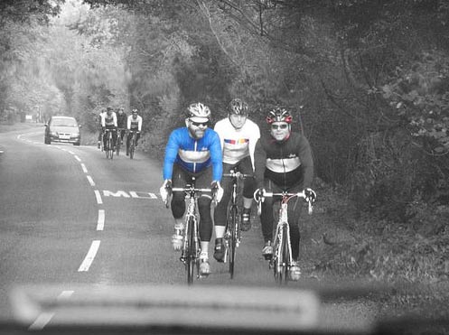
Yesterday was the end of the academic year, so without any teaching commitments I was able to go for a long ride towards Princes Risborough. I wanted to do the several climbs around the Chiltern ridge such as Whiteleaf ridge, Kop Hill and others. I’ve rarely ridden this roads before, so they were all new to me. I knew how to get to Princes Risborough, but after that I would try remember the OS map I had been studying and follow my intuition to go around looking for the best climbs.

It was certainly easy to find climbs in that part of the country. Every turn seemed to show a new climb, some were short and steep, otherwise were long and gradual. Some combined both steepness and length. For England, this part of the country is a relative climbers paradise. However, despite studying the map intensely over the past few days, I got totally lost and ended up going in the wrong direction. All I knew at one point is that at least I didn’t want to cycle down the A40 to London. I didn’t bring a map so I just kept trying to guess the best direction. I also asked an American touring cyclist with a map, but he was just as lost as me, and seemingly just as unconcerned. It was a good day to be on the bike and following your nose. It led to the slightly surreal experience of cycling three times past a local RAF base with two spitfires proudly standing by the side of the road. At least it was a memorable road side mark.

A memorable landmark on the ride.
One event in the ride will forever stick in the mind. I was beginning a descent, when a large lorry, with very high load came storming past with only a few spare inches. The 10 ton + lorry (and very high), then proceeded to descend this 10% hill (with 90 right and left turns) as if he wasn’t a lorry, but Fabian Cancellara descending on closed roads during the Tour de France. I was just stupefied by the speed and the way this lorry was descending at 40mph down a 10% gradient with sharp left and right hand turns. In one sense it was an amazing piece of driving and audacity. It was also a serious and fatal accident just waiting to happen. If I was benevolent dictator I would have just taken his driving license away there on the spot. But, alas we are not so interested in preventing accidents.
Anyway, eventually I found myself back to Princes Risborough and there managed to complete a few more long climbs. After several ascents of the Ridgeway ridge, the legs were feeling pretty tired so took the flat route back to Oxford via Chinnor. On getting home I saw I had done 90 miles in 4.45, at a pretty good average speed. I eagerly uploaded my GPS data so I could see where I had got lost, but more importantly see the altitude of all the climbing and the time taken to do different climbs.
Alas, of all rides I had done this year, the GPS had chosen this one go AWOL. The GPS route looked as it if had got as lost as me. Straight red lines went all other the place as it tried to create a picture from intermittent GPS signals. My GPS computer said 700 metres of climbing in 130Km, but this I knew was wrong.

GPS as art? I don’t think so! Though Damian Hurst might say this reflects the existential angst of modern cyclists.
The interesting thing is that in the pre-GPS days, I would have just been happy and satisfied to look at the OS map and known the satisfaction of climbing up all those hills. But, in these GPS-computer days, I was disappointed not to see the electronic confirmation of all the climbs that I had done. This is the gods of GPS, they give and take.
I thought fine, and went back to reading my OS map and told myself to ignore the stupid computer and just enjoy the satisfaction of riding 90 miles; and with no computer to tell me otherwise, I could decide I climbed a best guess of 3,000 + metres…
Who needs GPS to enjoy a ride anyway?
photo top: Placid Casual

Not having any fancy technology at my disposal, I experience a slightly different version of this GPS scenario.
I plan my route using online maps which track distance and altitude gain and then save it to a GPS file so I can log my rides. However, I inevitably get lost while trying to follow my planned route, which means I then have to try and piece together what ACTUALLY happened with another bout of methodical online mapping.
The hours I’ve spent clicking minor roads on mapping software would have been better spent working, earning money to buy some sort of device, I reckon. It’s all part of the fun though.
I have GPS, but still enjoy spending hours pouring over good old fashioned maps
Your route looks like an Imperial Star Destroyer from Star Wars (had to look the name up on the internet) with legs.
That is the total sum of my imagination done with.
My back yard!
Glorious countryside but darned hard to ride for this lump of lard! I deiberately did a few circuits of the hills one day to improve my fitness and suffered from my first (and only) occurence of the dreaded bonk. I didn’t know what was happening at the time and it was rather scary.
I ride these roads a lot but now limit how many hills I take on any one ride. What a shame your GPS failed to record the route – firmware update needed? Combine GPS with OS Maps and buy yourself an Active10 Satmap; heavy (for you) but extremely good on many levels
You may want to revisit the lorry paragraph, if you are able to make changes.
Beautiful part of the country, will be going back